10Peaks The Lakes 2018 – Ecological Briefing Notes
Ourea Events’ races are located in Britain’s greatest upland areas that often contain features of outstanding biodiversity value and importance. Occasionally, the features that provide this interest can be vulnerable to the wear and tear that may result from the passage of event participants. The risk of ecological damage is carefully assessed during early stages in the planning process for each event, when every effort is made to avoid sensitive ecological interest areas that could be disturbed by the event.
We are keen to encourage personal route selection choices by participants on our events to further avoid the risk of local ecological disturbance. This Ecological Briefing Note has been prepared for the 2018 10Peaks The Lakes event to identify key ecological interest features that contribute to the special character of the event area, with route selection comments to help minimise the risk of localized ecological disturbance.
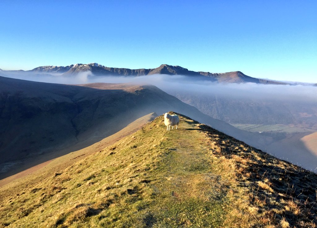
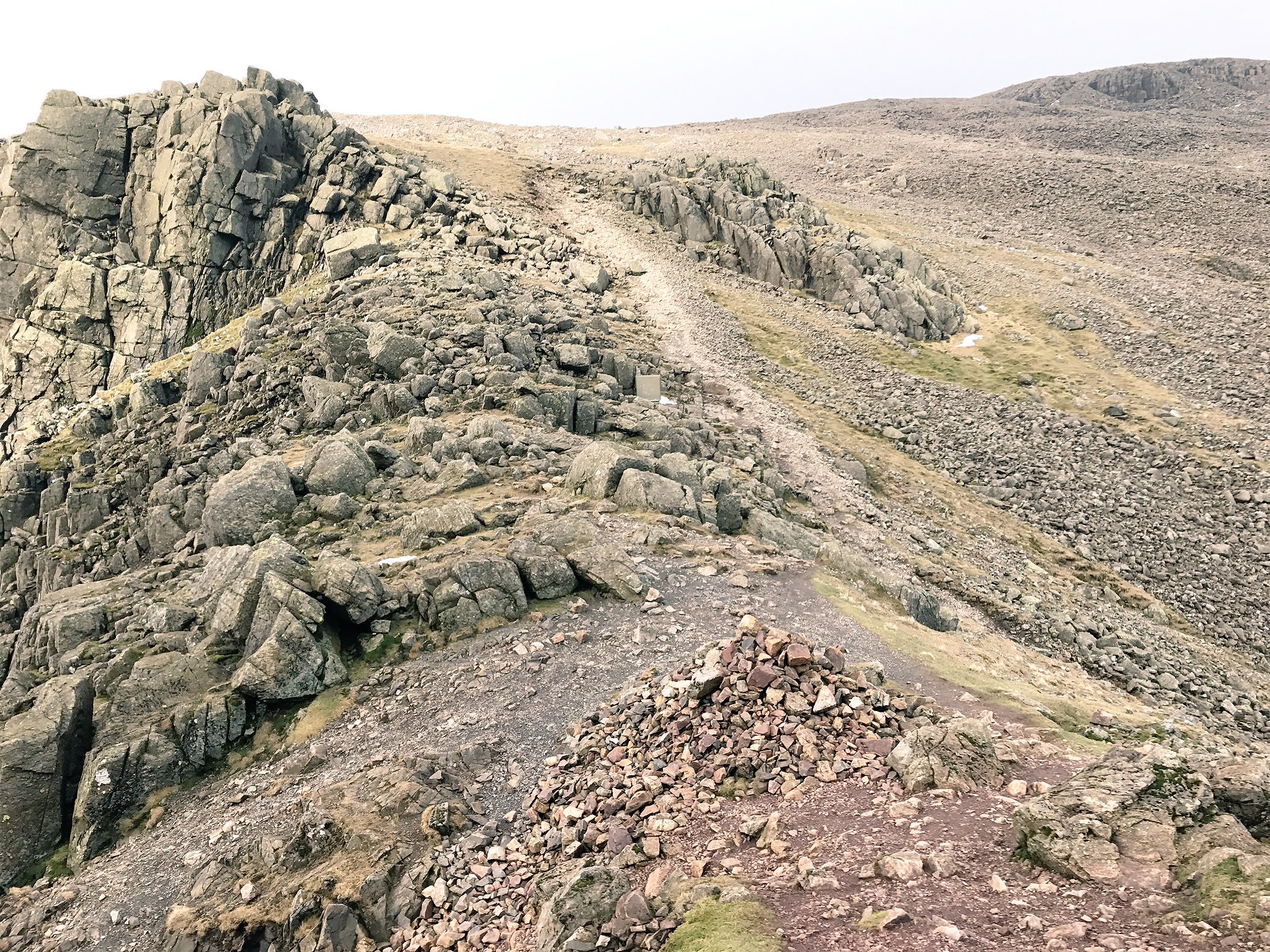
The 2018 10Peaks The Lakes event area is located within the northern and central fells region of the Lake District National Park, an area of sedimentary and igneous geology comprising the Skiddaw Group of slates and mudstones in the north and distinctive Borrowdale Volcanic rocks within the central and southern parts of the event area. The character of the event area landscape is strongly influenced by glacial action, creating a variety of distinctive ice scoured valley systems with glacial moraine deposits on lower slopes and ice-shattered boulder fields on the highest mountains.
A variety of distinctive upland wildlife habitats and vegetation types are present within the 2018 10Peaks The Lakes event area. These include four extensive areas of International nature conservation importance, and 24 areas of National nature conservation importance. The majority of the 10Peaks The Lakes route will follow existing hill paths, helping to avoid the risk of disturbance to sites and features of special nature conservation interest. For localised situations where event participants might be required to cross areas of land not crossed by hill paths this ecological briefing note should support personal route choices that will avoid the risk of significant ecological disturbance. This ecological briefing note has also been produced to communicate the special upland environmental interest of the event area to enrich the experience of participating in the 10Peaks The Lakes event.
- Dry acid grassland is a widespread vegetation type within the event area, where centuries of livestock grazing has converted heather moorland to open grassland. These areas provide a relatively robust vegetation type that can generally withstand the trampling effects of hill running.
- Extensive areas of dry acid grassland can include mosaics of other upland vegetation types such as blanket bog, heather-dominated heath vegetation and wet acid grassland creating areas of local vulnerability to a concentration of trampling by 10Peaks The Lakes participants. Upland vegetation mosaics can be of interest to ground-nesting birds, and as a consequence, care should be taken to avoid nest disturbance when crossing these areas. Use of existing paths where possible will help to minimise the risk of nest disturbance.
- Blanket bog is an important feature at several locations within the event area. Some of these areas comprise degraded blanket bog where bog vegetation has been lost and peat erosion gulleys (peat hags) have formed where and the underlying peat is being eroded.
- Disturbance of blanket bog by runners churning through peat hags has the potential to trigger further peat erosion by de-stabilising the peat surface. Wherever possible, route choices in these areas should try to link strips and patches of surviving moorland vegetation between the peat hags. These are often quite well-drained, providing areas of relatively robust vegetation and resistant to the trampling effects of running.
- In contrast to areas of degraded blanket bog, some locations on plateau landforms within the event area contain patches of high quality blanket bog with an intact vegetation surface that lack eroding peat hags. These are typified by areas of wet heath vegetation interspersed with shallow pools, often associated with Sphagnum These areas often comprise a mosaic of vegetation types that will include slightly raised areas of better drained peat with drier heather moorland vegetation. These will be far less vulnerable to disturbance through vegetation damage by trampling and should ideally be selected when making route choices for running through these intact blanket bog areas.
- Areas of wet acid grassland will be encountered where impeded drainage occurs within relatively level hill grassland areas or where groundwater emerges at the surface as seepages across more steeply sloping ground. Wet acid grassland can be of special nature conservation interest, in particular where groundwater seepages provide conditions for communities of specialised mosses, liverworts and other specialised plants. These vegetation types can be vulnerable to persistent disturbance effects of trampling and should ideally be avoided wherever possible by selecting routes that keep to dry acid grassland to by-pass wet grassland patches.
- Wet acid grassland at groundwater seepages on steep ground can be difficult to avoid where they cross valuable contouring lines. Avoidance of these areas could involve a significant route change and deviation from the desired contour level. Despite this, it would be ideal if damage to seepage zone vegetation could be minimised, often located within shallow gulleys, re-entrant features or associated with ground level rock outcrops that cross steep slopes.
- On hillsides, soil movements within dry and wet acid grassland areas can develop well-defined micro-terrace systems, often referred to as sheep walks or trods. These typically follow contours and can provide extremely useful running lines. Grassland vegetation at the edge of these micro-terraces is often friable and easily broken off. Care should be taken when using these features for contouring to avoid running on the edge of these terraces to minimise grassland damage.
- Distinctive semi-natural woodland of very high conservation interest is present within the event area, including broadleaved woodland within steep-sloping ravine landforms associated with upland streams and rivers. Many of the broadleaved woodlands are of great importance for the mosses and liverworts that grow on tree trunks and boulders on the woodland floor. The microclimate of ravine woodlands often maintains vegetation comprising highly specialised mosses, liverworts and other plants.
- The 10Peaks The Lakes route generally avoids the need to pass through or in close proximity to key areas of upland semi-natural woodland interest. Where the route passes small upland woodland fragments it is important that existing paths are used.
- A variety of boulder field and scree habitats are present within the event area that are potentially vulnerable to disturbance. Ice-shattered boulder fields on the highest mountain tops often support fragile montane grass-heath plant communities of extremely high nature conservation value. Existing paths through these areas should be used to avoid disturbance of these communities. Blocky scree often supports specialised plant communities that utilise the microclimate of sheltered spaces within the scree. Sections of the 10Peaks The Lakes route that cross these features should use existing paths and should always minimise disturbance of scree blocks.
- Specialised rock ledge plant communities are present at a number of locations within the event area. If 10Peaks The Lakes participants need to negotiate low rock outcrops great care should be taken to minimise disturbance of ledge vegetation.
- The event area has a substantial number of lakes and hill tarns that are generally of considerable nature conservation interest. Often this interest is associated with complex and specialised vegetation areas that develop at the margins of both large lakes and smaller hill tarns. There is no need for 10Peaks The Lakes participants to enter any water body within the event area, and all lake and tarn margins should be avoided.
- The event area contains a complex network of streams and rivers, some of which are potentially vulnerable to ecological disturbance from repeated crossing by runners. Some of the rivers within and surrounding the event area are covered by very high level nature conservation designations, including watercourses that could support internationally and nationally threatened animal species such as otter and water vole. In many cases, the nature conservation interest of these rivers and streams concerns use of the banksides by these animals. As a consequence, great care should be taken by 10Peaks The Lakes participants at stream crossings, preferring the use of bridges and stepping stones to minimise bank disturbance when entering and climbing out of stream channels.
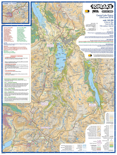
New for 2018 – key ecological information included on race map
We’re delighted to incorporate the salient points of the above into a new-for-2018 information panel, which sits natively on the race map that participants are issued at registration.